Activer/désactiver navigation
Rechercher
Nouvelle-Zélande
plus sur ce
le pays
Afghanistan
Albanie
Algérie
Allemagne
Andorre
Angola
Anguilla
Antigue et Barbude
Arabie Saoudite
Argentine
Arménie
Arouba
Australie
Austriche
Azerbaïdjan
Bahamas
Bahrein
Bangladesh
Barbados
Belgique
Belize
Bermudes
Bhutan
Biélorussie
Bolivie
Bosnie et Herzégovine
Botswana
Brunei
Brésil
Bulgarie
Burkina Faso
Burundi
Bénin
Cambodge
Cameroun
Canada
Cap-Vert
Caïmans
Chili
Chine
Chypre
Colombie
Comores
Congo, République du
Congo, République démocratique du
Cook, archipel de
Corée du Nord
Corée du Sud
Costa Rica
Croatie
Cuba
Côte-d`Ivoire
Danemark
Djibouti
Dominique
EAU
Equateur
Erythrée
Espagne
Estonie
Falkland, îles (îles Malouines)
Fidji
Finlande
France
Féroé, îles
Gabon
Gambie
Ghana
Gibraltar
Grenade
Groenland
Grèce
Guadeloupe
Guam
Guatemala
Guernesey
Guinée
Guinée Equatoriale
Guinée-Bissau
Guyane
Guyane Française
Géorgie
Haïti
Honduras
Hong Kong
Hongrie
Iles de Cocos
Iles de Noël
Iles Solomon
Iles Turques et Caicos
Inde
Indonésie
Irak
Iran
Irlande
Islande
Israël
Italie
Jamaïque
Japon
Jersey
Jordanie
Kazakhstan
Kenya
Kirghizistan
Kiribati
Kouweït
l`Afrique du Sud
Laos
Lesotho
Lettonie
Liban
Libye
Libéria
Liechtenstein
Lituanie
Luxembourg
Macao
Macédoine
Madagascar
Malawi
Malaysia
Maldives
Mali
Malte
Mariannes du Nord
Maroc
Marshall
Martinique
Maurice
Mauritanie
Mayotte
Mexique
Micronésie
Moldova
Monaco
Mongolie
Montserrat
Monténégro
Mozambique
Myanmar
Namibie
Nauru
Netherlands Antilles des Pays-Bas
Nicaragua
Niger
Nigeria
Niue
Norfolk
Norvège
Nouvelle-Calédonie
Nouvelle-Zélande
Népal
Oman
Ouzbékistan
Pakistan
Palau
Panama
Papuasie-Nouvelle- Guinée
Paraguay
Pays-Bas
Philippines
Pitcairn
Pologne
Polynésie Française
Porto Rico
Portugal
Pérou
Quatar
Roumanie
Royaume-Uni
Ruanda
Russie
République de l`Afrique Centrale
République Dominicane
République Tczéque
Réunion
Sahara Occidentale
Saint-Christophe et Nièves
Saint-Marin
Saint-Pierre-et-Miquelon
Saint-Thomas et Prince
Saint-Vincent et les Grenadines
Sainte-Hélène
Sainte-Lucie
Salvador
Samoa
Samoa occidentales
Serbie
Seychelles
Sierra Leone
Singapour
Slovaquie
Slovénie
Somalie
Soudan
Sri Lanka
Suisse
Suriname
Suède
Svalbard
Swaziland
Syrie
Sénégal
Tadjikistan
Taiwan
Tanzania
Tchad
Thaïlande
Timor d`Est
Togo
Tokelau
Tonga
Trinité-et-Tobago
Tunisie
Turkménistan
Turquie
Tuvalu
Uganda
Ukraine
Uruguay
Vanuatu
Venezuela
Virgin Islands
Viêt Nam
Wallis-et-Futuna
Yémen
Zambie
Zimbabwe
Égypte
États-Unis d'Amérique
Éthiopie
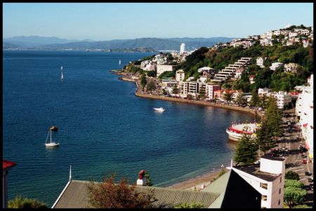
Wellington
plus sur ce
la ville
Auckland
Christchurch
Hastings
Kerikeri
Nelson
New Plymouth
Paihia
Queenstown
Rotorua
Russell
Wanganui
Wellington
Publicité gratuite
Contacts
Taharoa Iron Sands Heliport
Nouvelle-Zélande
List of airports Nouvelle-Zélande
Taharoa Iron Sands Heliport
Informations sur l'aéroport - Taharoa Iron Sands Heliport, Nouvelle-Zélande
Description
Valeur
IATA
(Code d'aéroport international Air Transport Association)
Aucun code IATA
Type
Héliport
Code de l'aéroport le plus proche
-
Code d'aéroport GPS
NZAH
Longitude
-38.1650009155273
Latitude
174.705001831055
Photos près de Taharoa Iron Sands Heliport, Nouvelle-Zélande
Photos de Taharoa Iron Sands Heliport
Matériaux informatifs - Wellington
Prix, coût de la vie Wellington
Temps Wellington
Fuseau horaire - Wellington, Nouvelle-Zélande
Météo - Wellington, Nouvelle-Zélande
Carte de Wellington
Drapeau national Nouvelle-Zélande
Wellington - le code de tél., comment appeler Wellington
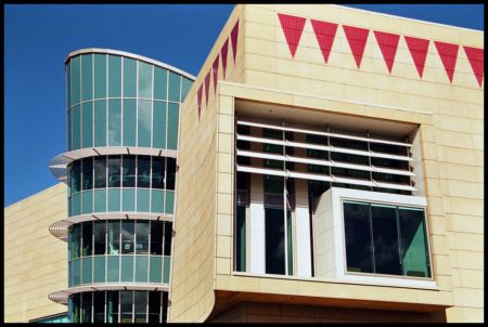
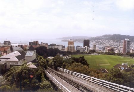
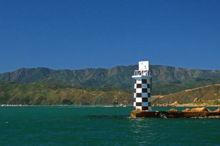
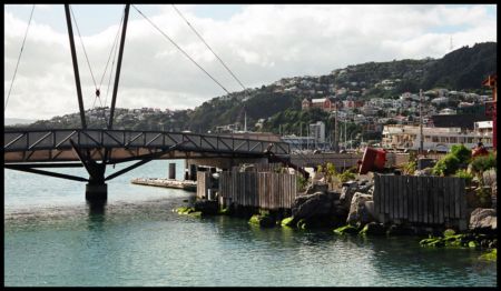
Photos de Wellington
Distance depuis Wellington, Nouvelle-Zélande
Matériaux informatifs - Nouvelle-Zélande
Unité monétaire Nouvelle-Zélande, Dollar de Nouvelle-Zélande
Convertisseur de devises Dollar de Nouvelle-Zélande
Ambassades Nouvelle-Zélande
Carte de la Nouvelle-Zélande
Liste des aéroports Nouvelle-Zélande
gallérie photo
Nouvelle-Zélande, Wellington
Ajoutez votre photo
Photos de Wellington »